
Activities in Utah › Nature Areas & Viewpoints › Glendale
Cedar City Ranger District
- Where
- Glendale, UT (Kane County)
- Indoors or outdoors
- Outdoors
- Good for
- outdoor lovers
Good to know
The Cedar City Ranger District sits on the Markagunt Plateau, where geological forces have shaped the landscape over time. This area appeals to those interested in natural formations and scenic terrain. Check what activities and access points are available before your visit.
Updated October 22, 2026
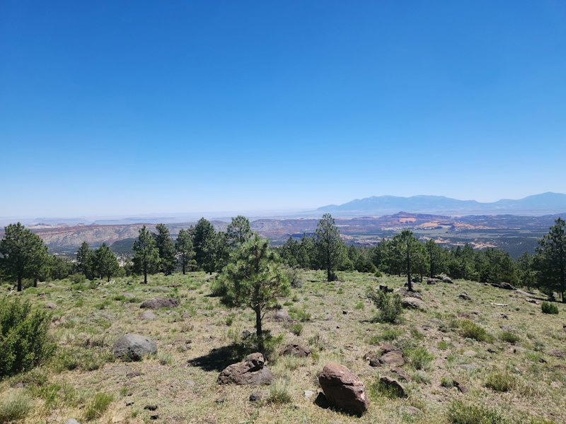
The Cedar City Ranger District is located on the Markagunt Plateau, a gently sloping, eastward tilted earth block that has been modified by erosion, volcanism, and some glaciations. Bordered by the beautiful pink limestone of the Wasatch formation (the same formation that forms the spires and landsc
About Cedar City Ranger District
Cedar City Ranger District is one of 5 nature areas and viewpoints in Glendale on Go Do, in Kane County. It's an outdoor activity. 183 other nature areas and viewpoints are within 30 miles; the closest is Brian Head-Panguitch Lake Scenic Byway, about 1.8 miles away. It suits outdoor lovers.
More nature areas & viewpoints nearby


Make a day of it
Eat nearby
- DC Pub & Grill · Restaurant · 2.3 mi
- Aunt Sue's Chalet · American · 2.3 mi
- Hot Mama's Pizza & Brew · Pizza · 2.3 mi
Places to stay
- Pinewoods Resort · Hotel · Duck Creek Village · 1.4 mi
- Duck Creek Village Inn · Hotel · Duck Creek Village · 2.2 mi
More to do nearby
- Duck Creek · Campground · 2.7 mi
- Alpine MOTOR Sports · Go-Karts & Racing · 1.0 mi
- The Yoga Studio at Aspen Creative · Classes & Lessons · 2.3 mi
- Tanner Family Navajo Lake Fun · Lake & Boating · 2.3 mi
Common questions
Where is it?
Glendale, Utah.
Nature Areas & Viewpoints in UtahActivities in GlendaleAll activities in UtahEvents this week