Activities in Utah › Nature Areas & Viewpoints › Mexican Hat
Goosenecks State Park
- Where
- UT-316, Mexican Hat, UT (San Juan County)
- Indoors or outdoors
- Outdoors
- Good for
- outdoor lovers
- Phone
- +1 435-678-2238
Good to know
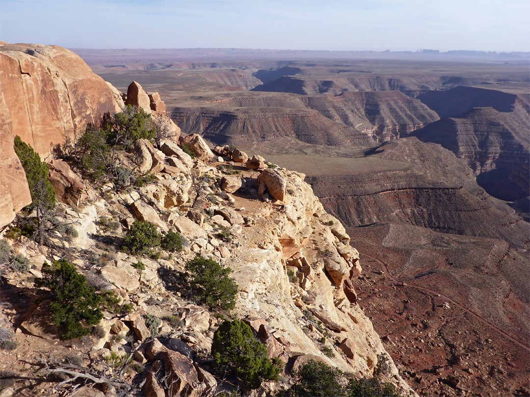
Goosenecks State Park overlooks a deep meander of the San Juan River carved over 1,000 feet deep, located near Mexican Hat in southern Utah. It appeals to visitors interested in geological formations and dramatic river canyons. It's positioned near the state's southern border for those exploring that region.
Updated October 22, 2026

Goosenecks State Park is a state park in the U.S. state of Utah, overlooking a deep meander of the San Juan River. The park is located near the southern border of the state a short distance from Mexican Hat, Utah. Millions of years ago, the Monument Upwarp forced the river to carve incised meanders over 1,000 feet (300 m) deep as the surrounding landscape slowly rose in elevation.
About Goosenecks State Park
Goosenecks State Park is a nature area or viewpoint in Mexican Hat, Utah, in San Juan County. It's an outdoor activity. Within 30 miles there are 29 other nature areas and viewpoints, the nearest being Goosenecks Viewpoint (about 0.1 miles). It's a good fit for outdoor lovers.
More nature areas & viewpoints nearby

Make a day of it
Eat nearby
- Olde Bridge Grill · American · 3.5 mi
- Remington Hall · Restaurant · 4.8 mi
- San Juan Inn restaurant · Restaurant · 3.5 mi
Places to stay
- San Juan Inn · Hotel · Mexican Hat · 3.4 mi
- Hat Rock Inn · Hotel · Mexican Hat · 3.8 mi
Common questions
Where is it?
UT-316, Mexican Hat, Utah.
Nature Areas & Viewpoints in UtahActivities in Mexican HatAll activities in UtahEvents this week