
Activities in Utah › Hiking Trails › Moab
Chicken Corners Trailhead
- Where
- Moab, UT (Grand County)
- Indoors or outdoors
- Outdoors
- Good for
- outdoor lovers
- Phone
- +1 435-259-2100
Good to know
This 4X4 route follows canyons and climbs to Hurrah Pass with views down to the Colorado River near Moab. It's suited for those comfortable with four-wheel-drive terrain looking for a scenic backcountry experience. Check trail conditions before heading out, as canyon routes can be affected by weather.
Updated October 22, 2026
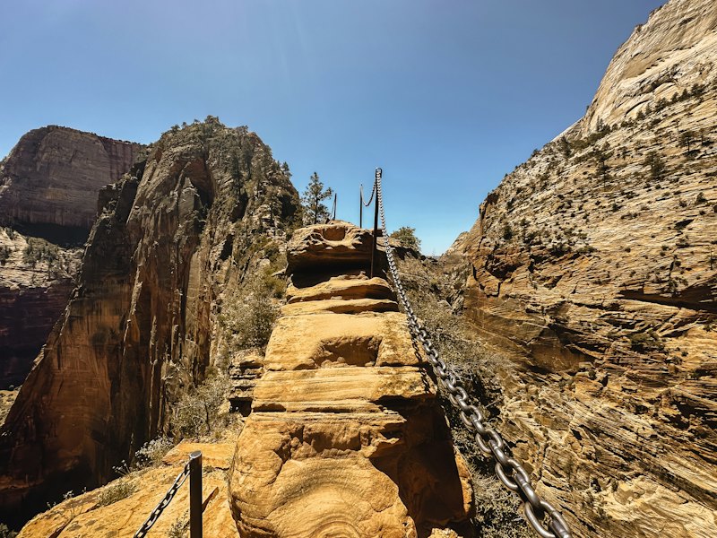
This 4X4 route travels the Colorado River Canyon just below Moab, follows a spectacular part of Kane Springs Canyon, climbs the Kane Creek anticline to Hurrah Pass, and descends to benches above the Colorado River. The route dead-ends about 400 feet above the river across from Dead Horse Point State
About Chicken Corners Trailhead
Chicken Corners Trailhead is one of 184 hiking trails in Moab on Go Do, in Grand County. It's an outdoor activity. Within 30 miles there are 273 other hiking trails, the nearest being Hunter Canyon Trailhead (about 0.9 miles). It suits outdoor lovers.
More hiking trails nearby

Make a day of it
Eat nearby
- Chicken Corners Trail, Moab Ut · Chicken · 3.3 mi
- Chicken Corners-Off Road · Chicken · 3.7 mi
Places to stay
- The Domes · Hotel · Moab · 3.2 mi
- Base Camp Adventure Lodge · Hotel · Moab · 3.0 mi
More to do nearby
- Hunters Canyon Camping Area · Campground · 0.9 mi
- Anticline Overlook · Nature Area & Viewpoint · 2.5 mi
- Potash Road Dinosaur Tracks and Petroglyphs · Historic Site · 2.3 mi
Common questions
Where is it?
Moab, Utah.
Hiking Trails in UtahActivities in MoabAll activities in UtahEvents this week